Role: UX Researcher/Product Designer
Scope: Research, content strategy, information architecture, interaction design, prototyping, and usability evaluation across multi-stakeholder IoT ecosystems
Context
Safe Cities focused on studying and testing IoT-based product and service ecosystems aimed at improving safety and well-being in public urban spaces.
Within the broader context of Smart Cities and increasing adoption of sustainable mobility (walking and cycling), the project explored how sensor data (such as air quality, noise levels, accessibility, and people density) could be leveraged to support safer routes, informed decision-making, and improved communication between citizens and urban services.
The work addressed both citizen-facing tools and professional urban monitoring systems.
The Problem
Urban sensor data is increasingly available, but often underused or fragmented across systems that are difficult to interpret or act upon.
At the same time:
• Route planners typically optimize only for time and distance, ignoring safety, comfort, and environmental factors
• Urban monitoring dashboards are often detached from citizen needs and real-time feedback
This limited the ability to support safer mobility choices and meaningful interaction between the public and urban infrastructure services.
Core Design Question
"How can IoT-driven urban data be translated into usable decision support tools for both citizens and professional stakeholders, while accounting for diverse needs, contexts, and responsibilities?"
Understanding the Environment
Understanding the urban safety ecosystem required accounting for perspectives from multiple stakeholder groups, including the general public, police departments, private security firms, fire departments, and public transportation companies.
Research activities captured key dimensions shaping interaction with urban systems:
• Perceptions of safety and well-being in public spaces
• Mobility habits and preferences
• Operational requirements and constraints of professional stakeholders
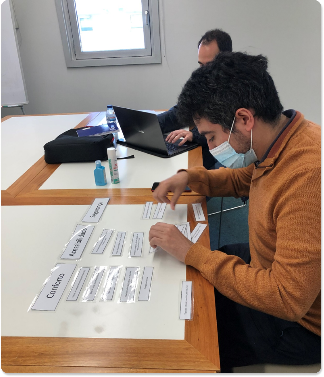
A PACT analysis was used to examine how people, activities, contexts, and technologies influenced interaction with IoT-driven services.
In parallel, existing route planners were analyzed to identify common interaction patterns, interface conventions, and functional baselines. Literature research and field studies were also conducted to understand prevailing approaches to urban monitoring dashboards and professional workflows.
This work highlighted the need for solutions capable of translating complex sensor data into role-specific, actionable information for both citizen-facing and professional use.
Explorations and Key Decisions
Insights from qualitative and quantitative research informed the definition of two complementary solution spaces:
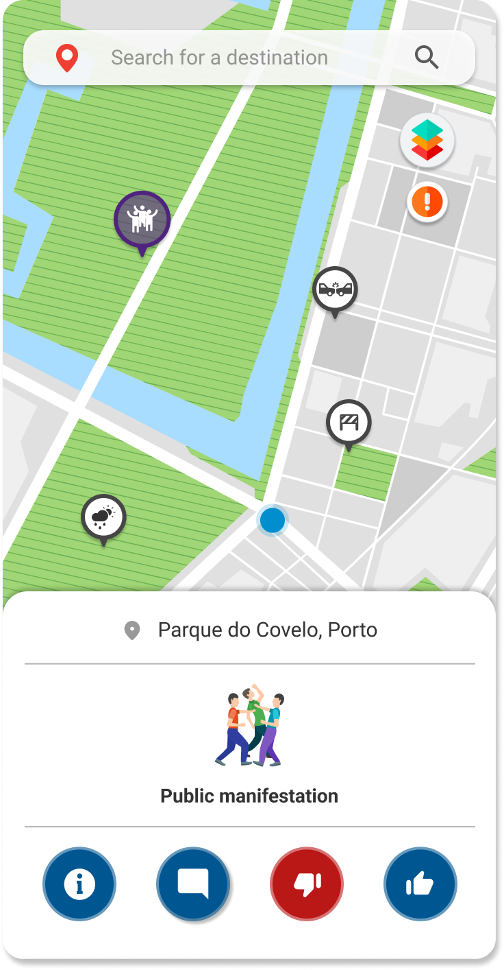
Route Planning
• A route planning application prototype was designed to incorporate parameters beyond time and distance, such as safety, environmental conditions, and accessibility
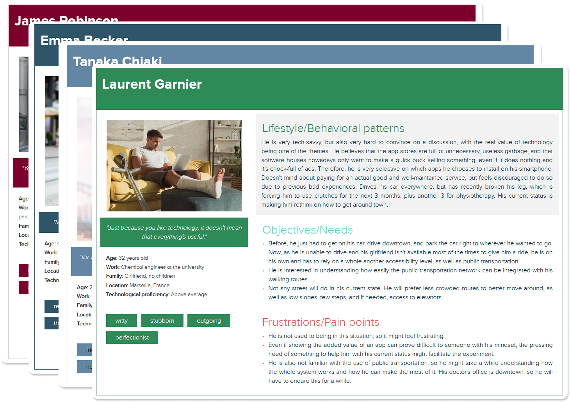
• User personas, use cases, user journeys, and information architecture were developed to support diverse mobility needs
• The route planner underwent four rounds of usability testing to evaluate information flow, interaction patterns, and overall usability. Both objective and subjective measures were used to assess satisfaction, ease of use, and perceived usefulness.
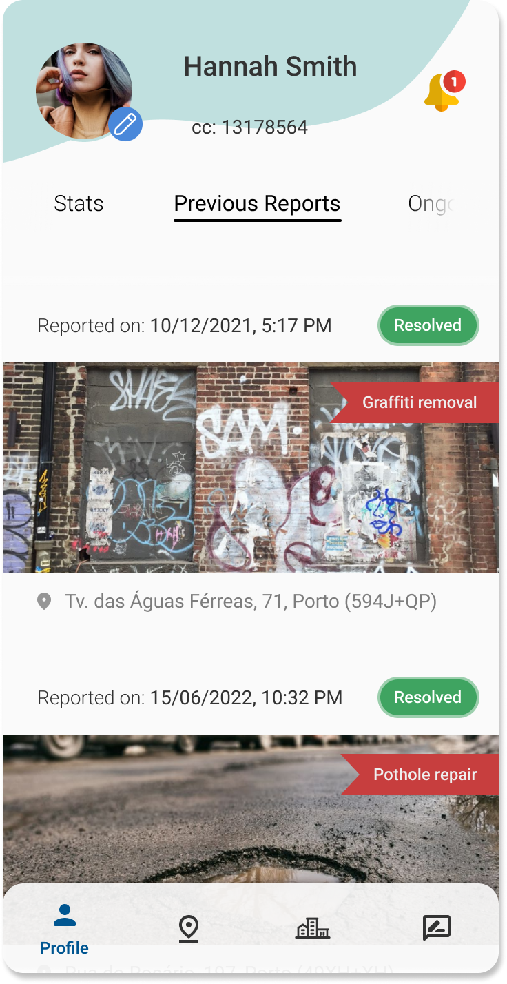
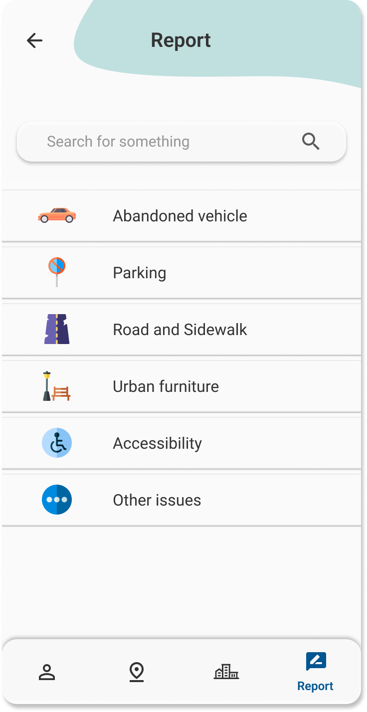
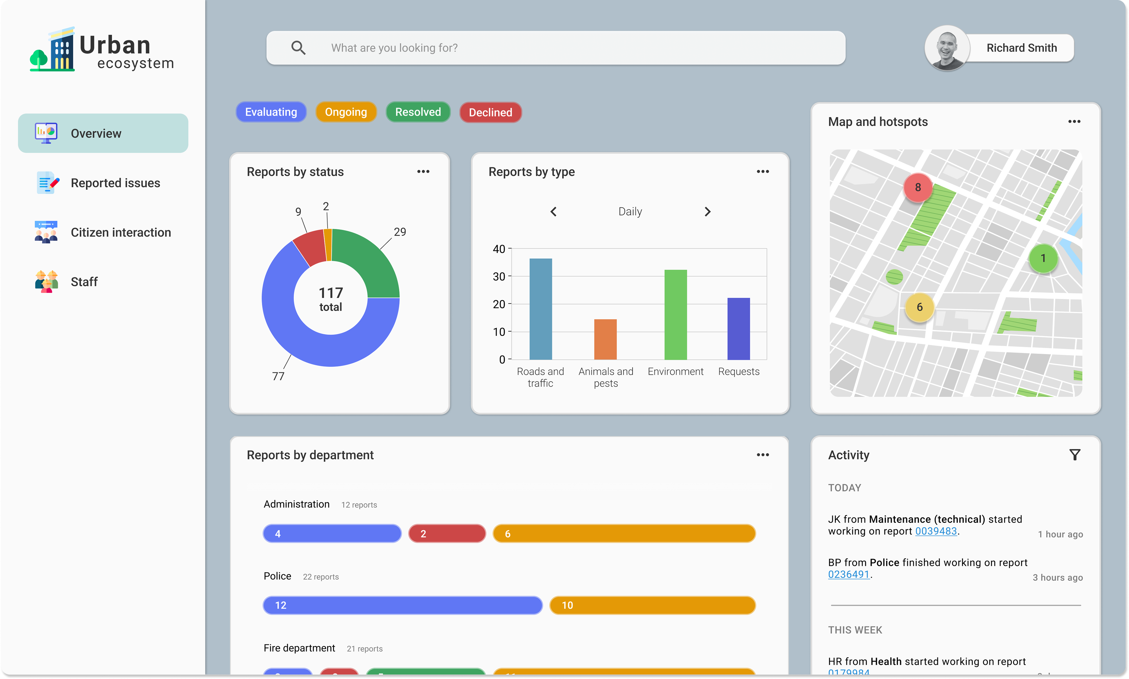
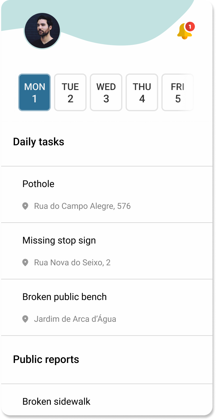
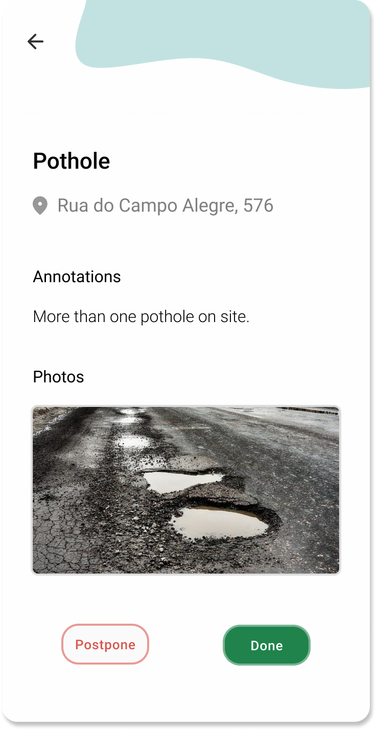
Urban Monitoring Ecosystem
• A three-part urban monitoring ecosystem was designed to address distinct stakeholder needs (General public, Management, and Field agents)
• The ecosystem emphasized communication and coordination between these roles
Two rounds of supervised walkthroughs with targeted professional stakeholders were conducted to evaluate functionality, system architecture, and usability.
Findings from usability testing, retrospective interviews, and cognitive walkthroughs were used to iteratively refine both solutions.
Outcomes and Impact
• Prototype of a multi-parameter route planning application supporting safer and more informed mobility choices
• Prototype of a three-part urban monitoring ecosystem tailored to citizen and professional stakeholders
• Evaluation through multiple rounds of usability testing with public and professional users
• Contributed to nine peer-reviewed publications, including four focused studies